Canary Islands · Spain
Gran Canaria
A continent in miniature. And three ways to stay in it.
Where to stay
Our apartments in Gran Canaria
All three are in Puerto Rico, on the south-west coast, and all three are apartments with a kitchen — the format that works best on an island where you go out a lot and come back late. What separates them is the size of the complex and what each terrace offers.
-
Puerto Rico
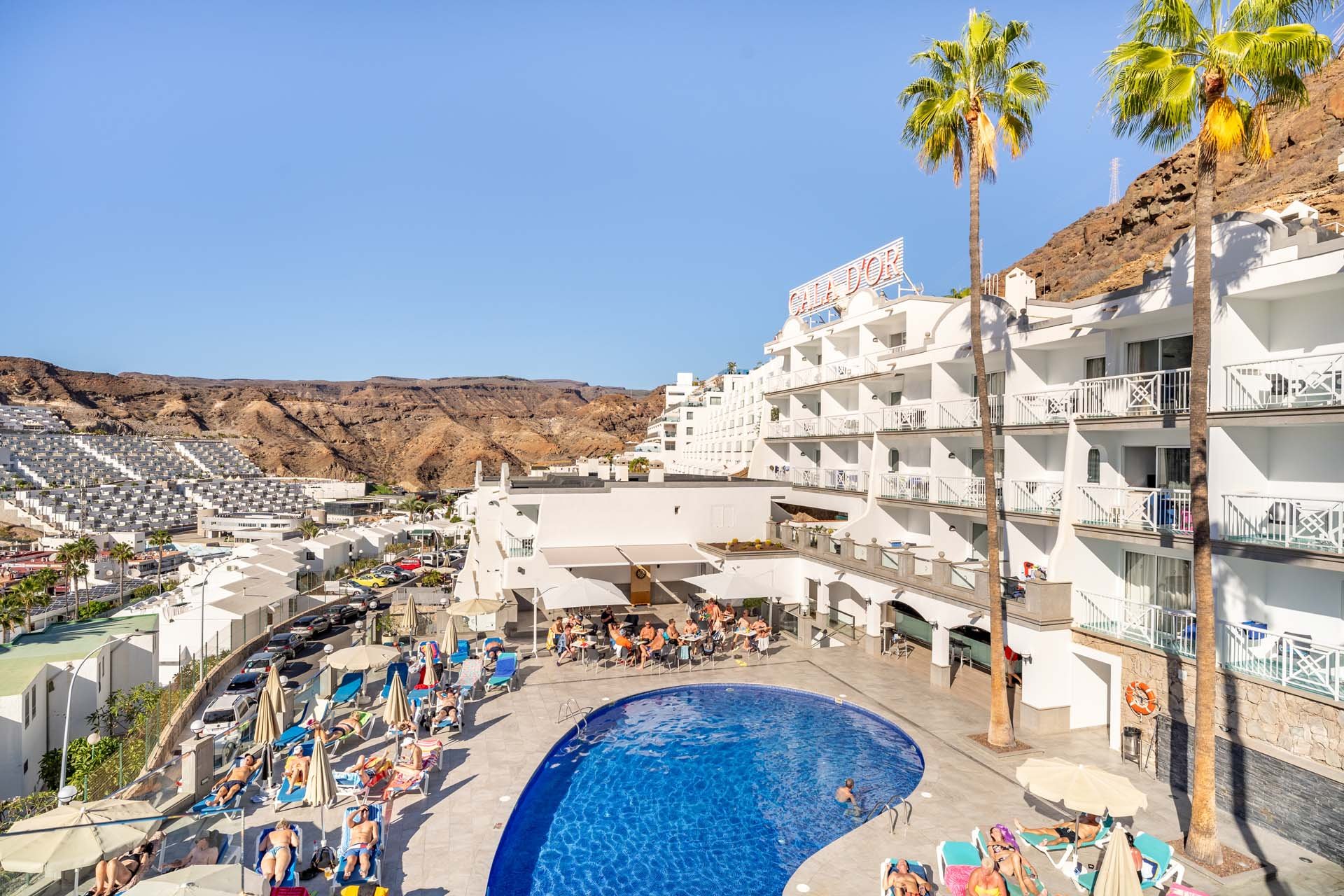
Cala d’Or Apartments
The largest of the three, and the one that opens the most doors
Seventy-nine one-bedroom apartments above the Puerto Rico valley, looking out to the Atlantic. Guests also get access to the infinity pool and terrace at Altaïr, which is a short walk away.
- Accommodation
- 79 one-bedroom apartments
- Best for
- Families and longer stays
- Access to the Altaïr pool
- Rooftop sun terrace
- Cala d’Or Pool Bar
-
Puerto Rico
Altaïr Suites
An infinity pool and Balinese beds over the Atlantic
A recently refurbished complex whose rooftop is its best argument: an infinity pool looking out to the ocean, Balinese beds, and a small pool bar where you eat without leaving the water for longer than necessary.
- Accommodation
- Suites with a kitchen
- Best for
- Couples and short breaks
- Infinity pool with ocean views
- Balinese beds on the terrace
- Altaïr Pool Bar
-
Puerto Rico
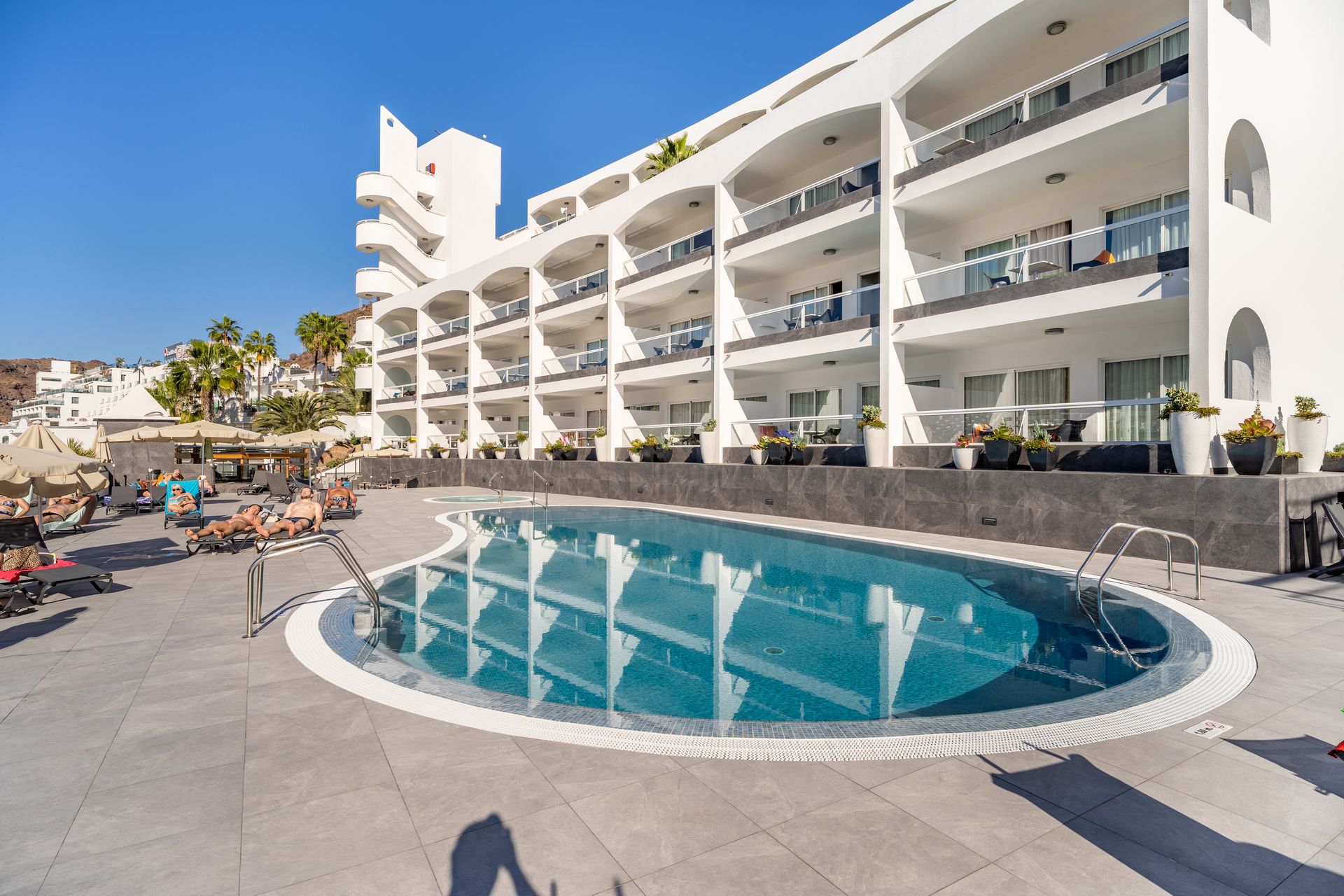
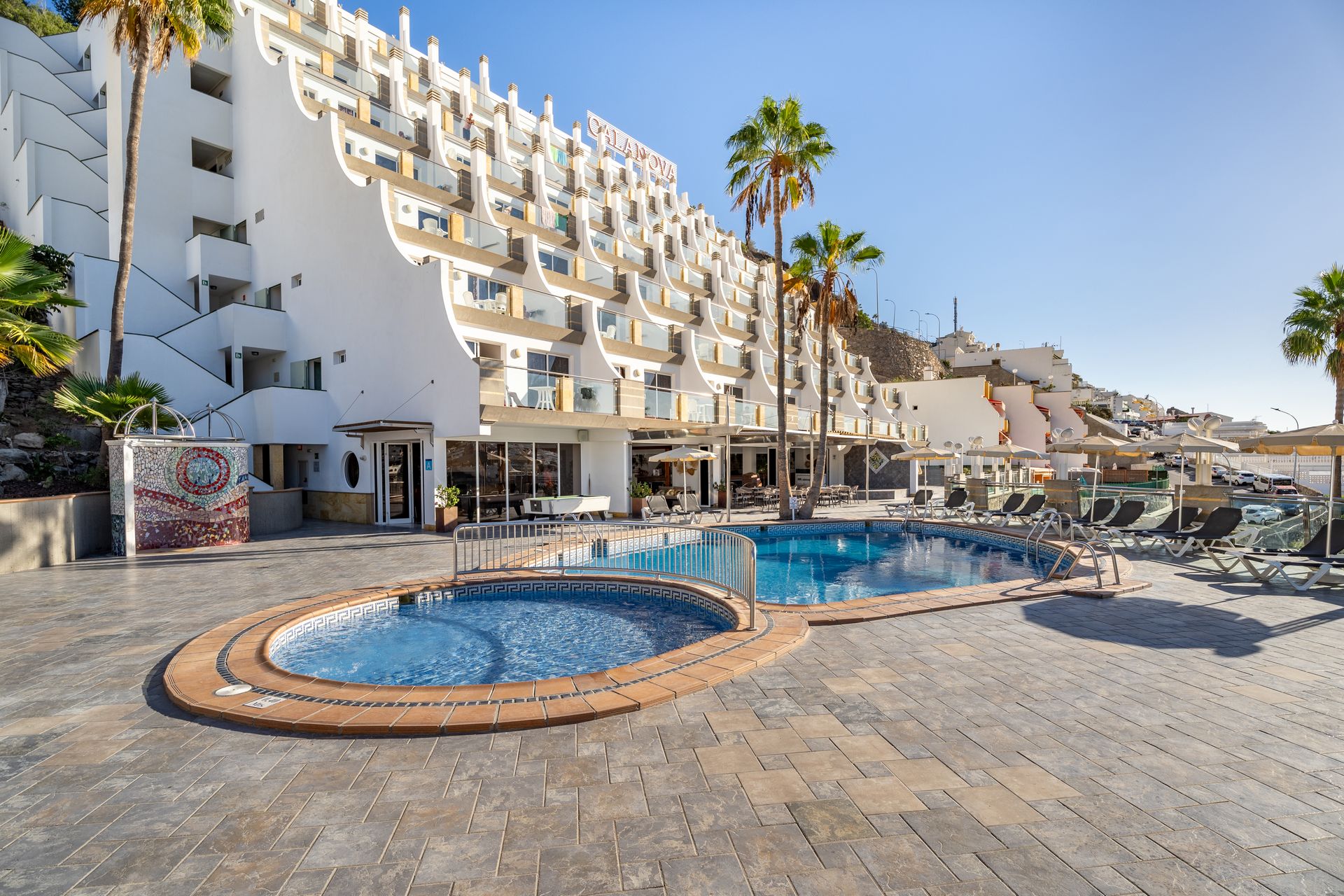
Cala Nova Apartments
Fifty-nine apartments facing the ocean
The quietest of the three. One-bedroom apartments with views split between the pool, the valley and the Atlantic, and a sun terrace turned towards the sea.
- Accommodation
- 59 one-bedroom apartments
- Best for
- Anyone after quiet
- Sea-facing sun terrace
- Cala Nova Pool Bar
- 24-hour reception
Direct booking · Best rate guaranteed
The destination
A continent in miniature
Gran Canaria gets called a continent in miniature, and for once the cliché holds: forty minutes of driving takes you from the dunes of the south to a mountain pine forest at fifteen hundred metres, and on to the cliffs of the west. The landscape changes so abruptly it is hard to believe it is the same island.
More than forty per cent of the territory has been a UNESCO Biosphere Reserve since 2005, and since 2019 the Sacred Mountains of the interior are a World Heritage Site. The climate does the rest: around twenty degrees all year, so the season never really closes.
- 1,560
- km² of island
- 236
- km of coastline
- 1,956
- m at its highest point
- 2005
- Biosphere Reserve

01 · Coast
A desert that ends in the sea
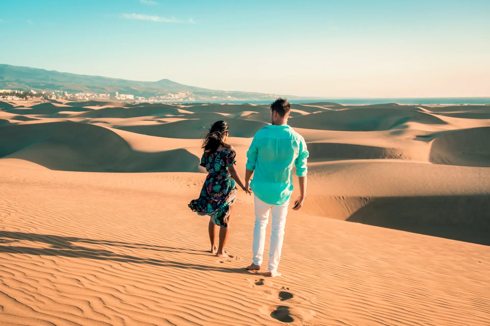
The Maspalomas dunes have been a Special Nature Reserve since 1994 and move between two and five metres a year, pushed by the trade winds. Behind them lie the lagoon and the palm grove of the Oasis; in front, six kilometres of beach. To the west, Amadores and the coves of Mogán close the coast in bays of still water.

02 · Summits
The island that rises nineteen hundred metres
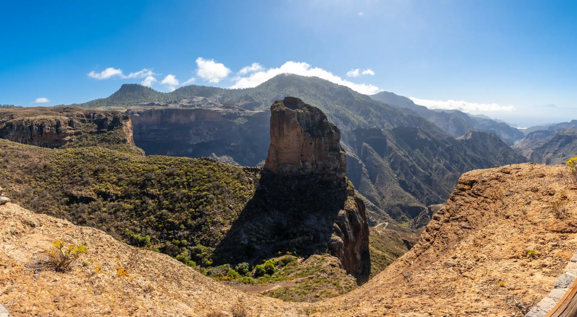
The interior is another island. The Roque Nublo, an eighty-metre monolith and a Natural Monument, crowns a landscape of ravines and pine woods where in 2019 UNESCO recognised the prehispanic caves and ceremonial spaces of Risco Caído and the Sacred Mountains as World Heritage.
03 · Villages
Ravines, canals and houses in the rock
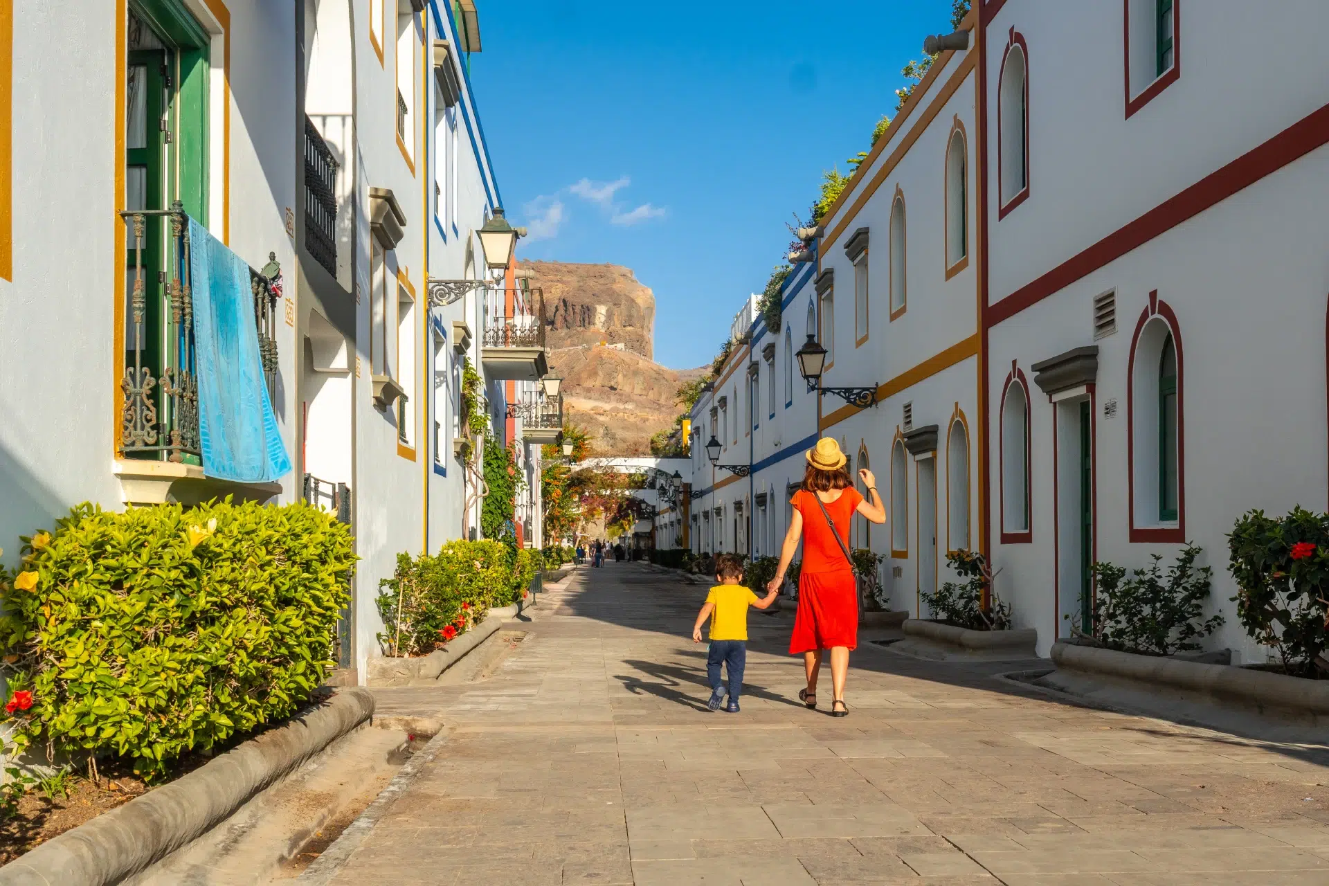
Puerto de Mogán arranged its whitewashed houses around water canals and earned itself the nickname of the Canarian Venice. In the east, the Guayadeque ravine still has inhabited cave houses and restaurants cut literally into the wall. And in the north, Teror has been holding its Sunday market for more than two centuries.
What to see
The island, zone by zone
From the dunes of the south to the mountain pine forests is forty minutes by car and a change of landscape that feels like a different country. These are the five zones the island divides into.
01 South Maspalomas, Mogán and Puerto Rico: what you have on your doorstep. 4 places
Nature
Maspalomas Dunes
A Special Nature Reserve since 1994, with some four hundred hectares of dunes advancing between two and five metres a year on the trade winds. Behind them lie the lagoon and the palm grove of the Oasis.
Before you go Walk it on the marked paths only. Leaving them, and entering the strict reserve area, is prohibited.
Village
Puerto de Mogán
A former fishing village that arranged its whitewashed, bougainvillea-covered houses around a network of water canals — hence the Canarian Venice nickname.
Before you go Parking is hard by mid-morning; go early.
Beach
Playa de Amadores
A man-made beach of pale sand built on a rocky headland between Puerto Rico and Mogán, in a closed bay where the water is always calm.
Before you go About ten minutes by car from the apartments. Paid parking and very busy in season.
Monument
Maspalomas Lighthouse
A historic lighthouse on the island’s southern tip, where the Meloneras seafront promenade begins and runs towards the hotel district.
Before you go The promenade is free and flat — a good sunset plan.
02 Summits The interior: World Heritage since 2019 and the heart of the Biosphere Reserve. 4 places
Mountain
Roque Nublo
A Natural Monument and the symbol of the island: an eighty-metre basalt monolith crowning the Nublo Rural Park. A kilometre and a half of trail from the car park, twenty to thirty minutes uphill.
Before you go Since February 2025 a free advance booking is required at peak hours, with an hourly cap and QR check. Book before you set off.
Viewpoint
Pico de las Nieves
At 1,949 metres, the island’s best-known summit viewpoint; on a clear day you can see Teide rising above the clouds. It is not the island’s highest point — that is Morro de la Agujereada, at 1,956.
Before you go You can drive almost to the top, but the summit is a military base: only the lower viewing platform is open.
Village
Tejeda
A white village wedged into the central caldera among pines and almond trees, and one of the Most Beautiful Villages in Spain. In January and February, the almond blossom.
Before you go Mountain roads with very tight bends and little parking.
Monument
Risco Caído and the Sacred Mountains
A UNESCO World Heritage Site since July 2019: eighteen thousand hectares of cultural landscape with cave dwellings, granaries and prehispanic ceremonial spaces across Artenara, Tejeda, Gáldar and Agaete.
Before you go The Risco Caído site cannot be visited freely. Visits are arranged through the interpretation centres — check the current arrangements.
03 Las Palmas and the north The city, its founding quarter and the northern villages. 4 places
Beach
Playa de Las Canteras
Three kilometres of sand in the centre of Las Palmas, sheltered by La Barra, a natural reef some two hundred metres offshore that turns half the beach into a natural pool. Blue Flag continuously since 1989.
Before you go Urban and free, but street parking is scarce: use a car park.
Monument
Vegueta and the Casa de Colón
The city’s founding quarter, a National Historic-Artistic Site since 1973. The Casa de Colón occupies the old Governors’ House, which Columbus visited in 1492, and devotes thirteen rooms to the link between the Canaries and the Americas.
Before you go The museum closes at three at weekends. Free entry the first weekend of each month.
Village
Teror
A town of mansions with carved pine balconies around the Basilica del Pino, begun in 1767 and a National Monument. Its Sunday market has been running for more than two hundred years.
Before you go Sunday morning is the best moment and the worst for parking.
Monument
Cenobio de Valerón
A prehispanic communal granary carved beneath a great tuff arch, with more than three hundred cavities. In use until the conquest at the end of the 15th century.
Before you go Ticketed site with set hours. The access stairway is steep.
04 West Agaete, Tamadaba and the cliffs of La Aldea. 4 places
Village
Agaete and Puerto de las Nieves
A white town at the foot of the Tamadaba massif, with a fishing harbour, natural pools and seafood restaurants. Of the Dedo de Dios only the base remains: the rock needle broke in tropical storm Delta, in November 2005.
Before you go The ferry to Tenerife leaves from here, about an hour and twenty minutes across.
Nature
Tamadaba Natural Park
A north-western massif with some two thousand hectares of Canary pine forest, among the best preserved in the archipelago.
Before you go Reached by the GC-200 from Agaete or La Aldea. Narrow tracks and frequent summer closures for fire risk.
Viewpoint
Mirador del Balcón
A balcony over the western cliffs, looking along the run of ridges they call the dragon’s tails. A sunset classic.
Before you go It sits right by the GC-200 and costs nothing, but the car park is small.
Beach
Playa de Güigüí
An unspoilt western beach with not a single building, inside the Güigüí Special Nature Reserve.
Before you go Reachable only on foot — about five kilometres of hard walking from Tasartico — or by water taxi. No services, no shade, no water: take everything.
05 East Ravines, a crater, and the largest botanical garden in Spain. 4 places
Nature
Barranco de Guayadeque
A Natural Monument and protected archaeological zone since 1991, between Ingenio and Agüimes. It still has inhabited cave houses, a chapel and an interpretation centre.
Before you go The road along the ravine floor is very narrow.
Food
Guayadeque cave restaurants
Dining rooms cut literally into the rock of the ravine, serving traditional Canarian cooking. It is not a set: the mountain is the wall.
Before you go Book a table at weekends.
Nature
Caldera de Bandama
A volcanic crater two hundred and sixteen metres deep, formed about five thousand years ago, with a farmed floor and the Bandama peak leaning over the rim.
Before you go You can drive to the viewpoint. Going down into the crater is an out-and-back with serious descent.
Nature
Viera y Clavijo Botanical Garden
The largest botanical garden in Spain, devoted to endemic Canarian flora and terraced down the side of the Guiniguada ravine on the edge of Las Palmas.
Before you go Check opening hours and entry conditions before going.
Frequently asked questions
What people usually ask us about Gran Canaria
Real questions from people planning a trip to the island, answered with concrete facts about our three complexes.
When is the best time to visit Gran Canaria?
Any time, and that is not a brochure answer: the temperature sits around twenty degrees all year and the sea does not drop below eighteen even in winter. November to March is when the difference with mainland Europe really shows. In summer the south is hotter and the north windier and cloudier.
Which part of the island should I stay in?
The south-west — Puerto Rico, Mogán, Maspalomas — if you want guaranteed sun, beaches and calm water; that is where our three complexes are. Las Palmas if you prefer a city, museums and Las Canteras beach on foot. The north and the interior are for driving and exploring rather than for staying.
Which of the three Cabau properties suits me?
Cala d’Or is the largest, with seventy-nine one-bedroom apartments, and its guests can also use the pool and terrace at Altaïr. Altaïr Suites is the one with the infinity pool and Balinese beds facing the Atlantic. Cala Nova, with fifty-nine apartments, is the quietest. All three are in Puerto Rico and all have a kitchen.
Do I need a hire car?
To stay around Puerto Rico and Mogán, no: the beach is nine minutes on foot and there are buses along the whole south coast. To really see the island — the summits, Agaete, the Guayadeque ravine — yes. Many of the places worth the trip have no direct public transport.
Do I need to book to climb Roque Nublo?
Yes, since February 2025. Access to the trail requires a free advance booking during peak hours, with a limited hourly quota and QR checks. It is arranged through the Cabildo de Gran Canaria website. The walk itself is short: a kilometre and a half and twenty to thirty minutes uphill.
How many days do I need?
Five or six nights is enough to combine beach days with two excursions: one to the summits — Roque Nublo, Tejeda, Pico de las Nieves — and one to the north, taking in Teror and Las Palmas. A week lets you add the west, Agaete and Tamadaba, without rushing.
Is it a good destination with children?
Yes. The south-western beaches, especially Amadores and Puerto Rico, are enclosed bays with very calm, shallow water. Apartments with a kitchen help enormously with children’s meals and timings, and all our complexes have a pool.
What should you eat in the Canaries?
Papas arrugadas with mojo, green or spicy, comes first. Then: queso de flor from Guía, sancocho, ropa vieja, gofio in its many forms, and bienmesabe for dessert. To drink, the Gran Canaria denomination wines, from vineyards that climb remarkably high.
Can you swim in winter?
Yes. Water temperature in the south sits around nineteen or twenty degrees in the coldest months, similar to the Mediterranean in June. In the north the sea is rougher and cooler, and northern beaches are more for walking than swimming in winter.
Is it worth crossing to Tenerife?
As a day trip it is tight, but it can be done: the ferry leaves from Puerto de las Nieves in Agaete and takes about an hour and twenty minutes to Santa Cruz. It makes most sense if you want to see Teide, which from Gran Canaria is only a hint on the horizon on clear days.
What is the difference between the north and the south?
Practically the entire climate. The trade winds dump their moisture on the north, which is green, cooler and often cloudy; the south sits in the lee, dry and sunny. That is why beach tourism concentrates in the south and farming and forests in the north.
How far is the airport?
Gran Canaria airport is on the east of the island, near Telde, and the GC-1 motorway connects directly to the whole south coast. From there to the Puerto Rico area takes a little under an hour by car.